Take A Drive Along Tortola’s Ridge Road
By Claudia Colli
Take a drive along Tortola’s Ridge Road and explore the beauty of the BVI beyond its beaches. Tortola’s soft green mountains that run upwards from its shores open up a world of history, nature and tropical beauty.
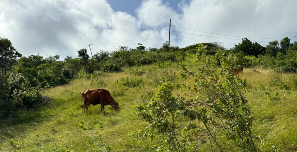
The mountains of Tortola are not the world’s highest – the BVI’s tallest is a mere 1,716 feet – nor the most dramatic. But they are user friendly, easy to hike up, warm at the bottom and cool at the top. Some of the hillsides are covered in a tangle of thorny green foliage, while others are carpeted in tall waving grass and speckled with grazing cattle.
On the lush north shore, terraced farms, planted with cassavas, pumpkins and sweet potatoes, defy gravity as they cling to amazingly steep hillsides. And along the ridge one can find groves of tropical splendor – bananas, avocadoes, mangoes and breadfruit. Interspersed along the Ridge Road are small communities of colorful West Indian homes of wood and concrete with hipped tin roofs and cool verandahs; adjoining gardens are splashed with brightly colored hibiscus, bougainvillea and frangipani.
Hiking through this verdant area is one of my favorite things to do. Add a picnic to the to the trip and you’ve created an outing with culinary flair. But with or without a picnic exploring the upper reaches of Tortola is not difficult.
Breathtaking Views
The best way to get a feel of Tortola from up high is to drive along the Ridge Road – although the more athletically inclined could walk it. The road acts as the island’s spine, running from Sage Mountain on the western end to just above Josiah’s Bay on the east. Because Tortola is steep and very narrow, in some places just a few miles wide, the views from up top can be breathtaking and there ae several places along the Ridge Road where one can glimpse a double view of both the north and south shores.
Being a West Ender, I usually access the Ridge Road from the scenic north shore fishing village of Carrot Bay, and I recommend where ever you are staying, you start here.
The Pirate Priest
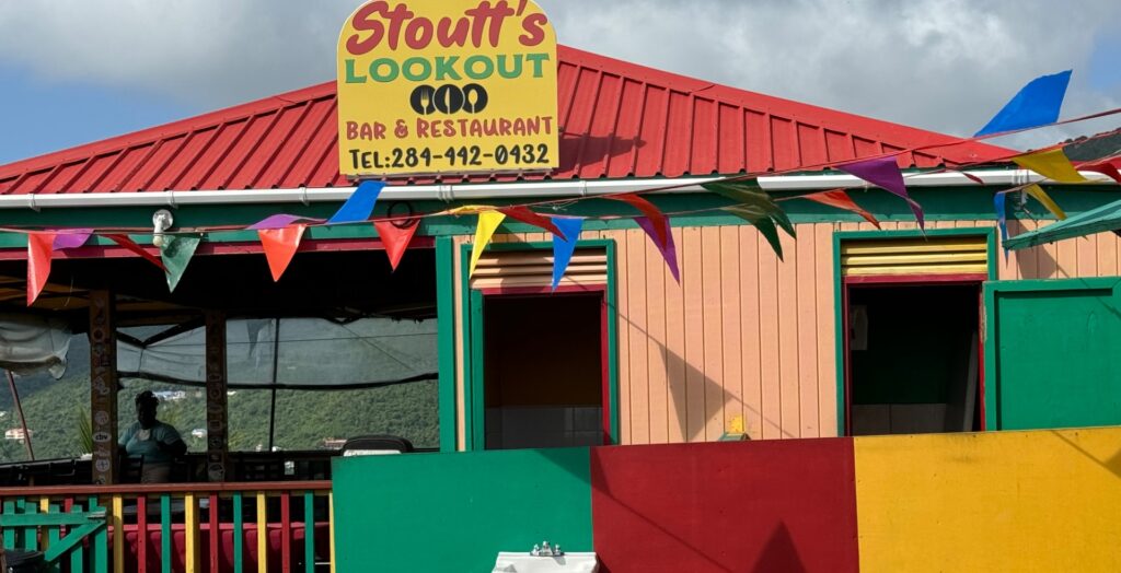
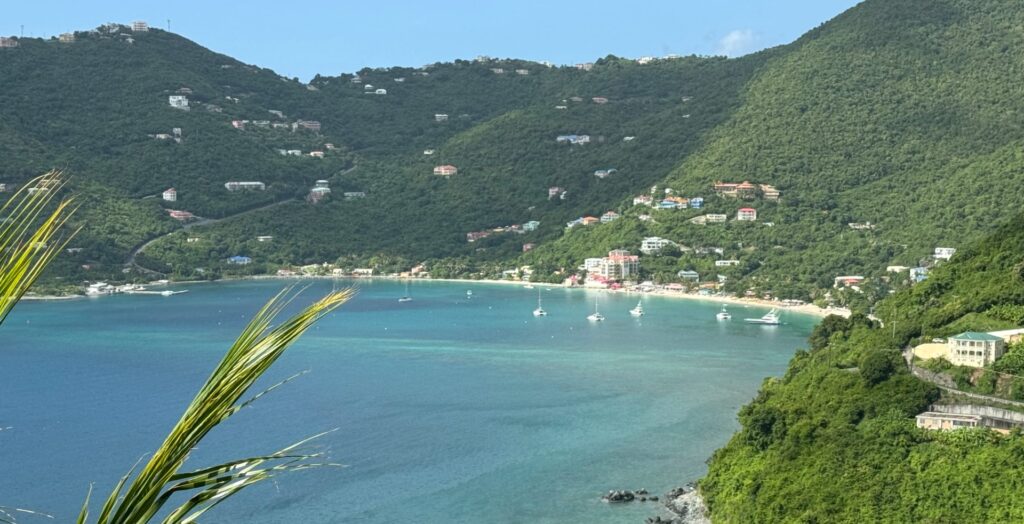
At Carrot Bay’s eastern end follow the road upwards, negotiating several hair pin bends (Tortola’s roads are not for the faint hearted) until you reach Stoutt’s Look Out. This aptly named bar affords a sweeping view of Cane Garden Bay and surrounding hillsides and if the hair-raising switchbacks took their toll a cool rum and coke might be in order.
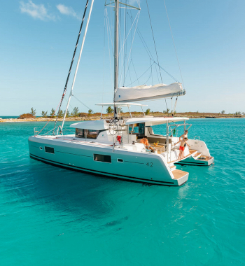
The 18th century St. Michael’s Church once stood in this location. The church has a colorful history. In 1745, the church’s rector was a reputed “pirate priest” who was said to have “combined duties ecclesiastical and piratical.” It seems the area’s lofty view of the north shore allowed the priest to spy a passing merchant vessel, swoop down from his mountainside perch and capture it. Today, from your own towering vantage point, you are more likely to spy a charter yacht.
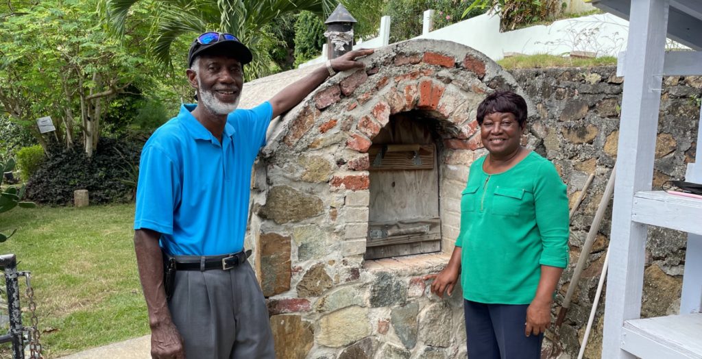
At Stoutt’s Lookout, continue upwards along the aptly named Windy Hill Road. In the plantation era, the area was known as Arundel, and was a major sugar producing region. The crumbling remains of sugar mills and plantation homes are scattered throughout Tortola’s hillsides.
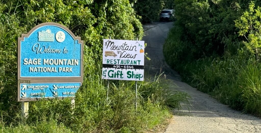
At the crest of the Windy Hill Road, turn right at the junction and make my way to Sage Mountain, the island’s highest point and the BVI’s first national park. Follow the road up to a parking area and a large sign with a map of the park. Here you will find a lookout featuring a panorama that sweeps across the north shore: Jost Van Dyke, Sandy Cay, Great and Little Tobago and St Thomas in the distance. On a clear day you might be able to make out the mountainous outline of Puerto Rico on the horizon.
The Sir Francis Drake Channel, named after the cunning adventurer who discovered this sheltered waterway in 1595 can be seen in the south. This was the route the navigator chose for his fleet as it headed westward from Virgin Gorda for the rich Spanish port of San Juan, Puerto Rico. The attack was unsuccessful but Drake nonetheless left his mark on the British Virgin Islands.
Sage Mountain
A road which eventually turns into a rough path leads from the parking area to the national park’s entrance. The beginning of the walk is past private land, and along the way you can glimpse small terraced farms. For the most part the path is shady, occasionally interrupted by sun-soaked views of the north shore. The park itself has two distinct sections. One is a dry West Indian forest, the other section is resplendent with lush tropical foliage. There is also trail to the top, and Tortola’s highest point, which is densely planted with mahogany trees. Mahogany once grew along much of Tortola’s hillsides, but were cut down in the plantation era, much of which were exported to England.
Sage Mountain is only one part of your Ridge Road adventure. From the Sage Mountain car park, follow the road down until you are back on the Ridge Road. Follow the road until you reach the junction at Rudy’s Outside Bar, an open-air wooden structure and a BVI landmark. If so inclined grab a cold one and a view of the north shore before continuing on your way. A few hundred yards to the east you will come to the junction at Meyers where you will turn left to continue alog the Ridge Road and past the Enis Adams Primary School. Continue eastwards towards East End. Go slow, the road is not in the best shape and you might have to dodge a pot hole or two.
About mid-way along the ridge you will find the Jenesis Studio, located above the road and across from a small park. This art gallery and museum of local culture is run by Reuben and Olive Vanterpool. It features Reuben’s paintings of villagers and life here in times gone by. Among the highlights are large dioramas of traditional Virgin Island life, along with an herb and tropical fruit garden. Olive and Reuben will happily explain the medicinal plants and their uses.
The Mural
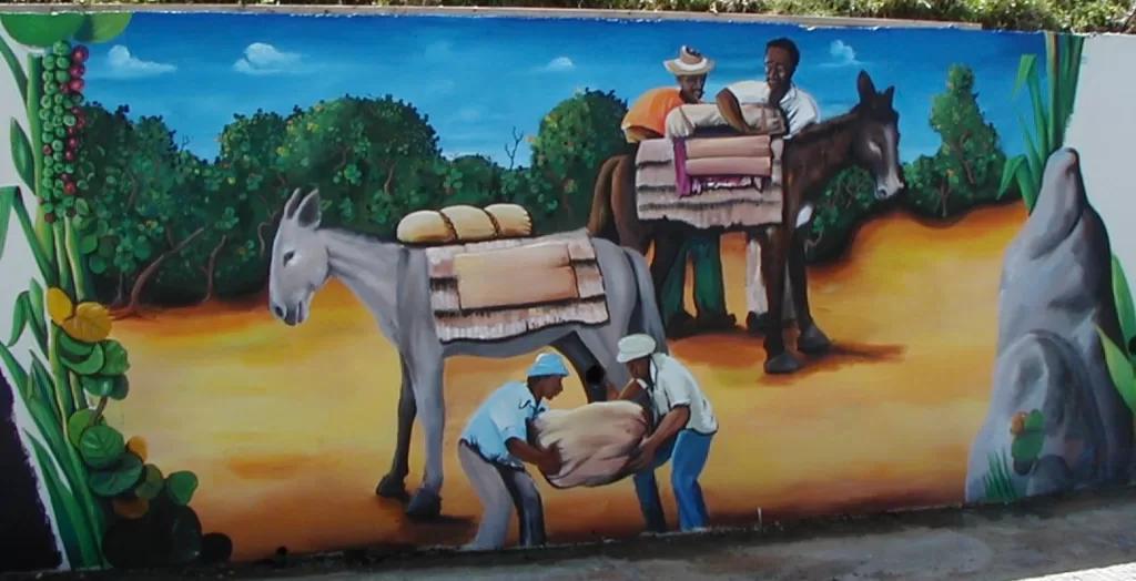
As you continue on your eastward journey, you will come to a remarkable art project: a series of murals painted on a long retaining wall. The historical and cultural scenes from Tortola’s past were painted by some of the BVI’s most well-known artists, and make for a great photo op.
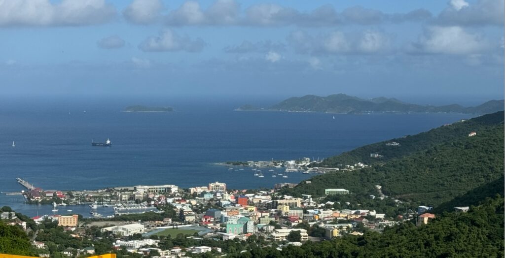
Next on your journey, you will come to a wooden lookout perched on a cliff edge. Make a quick pit stop here for a stunning view of Road Town, Road Harbour and the Sir Francis Drake Channel. As you look at the islands in the distance, stretch your imagination, as Columbus must have, when he first named the area. According to popular belief, the explorer dubbed these islands Islas Virgenes because of their profusion ad untouched beauty. In all there are over 40 islands and cays in the Virgin Islands and quite a number of them can be seen from the ridge.
Driving along the ridge is filled with unexpected surprises as views pop up intermittently of remote sparkling white north shore beaches including Trunk, Rogues and Cootens Bays. These can be reached by steep and often rugged roads, so if you want to attempt visiting one, make sure you have a rugged four-wheel drive vehicle.
As the road continues to wind eastwards, you will come to a junction. Turn right and you will go towards the south shore and the east end village of Long Look. But I instead suggest you go left at the junction to Josiah’s Bay, a beautiful swathe of white sand that attracts an international group of surfers in the winter months when the swells roll in.
Here you can lounge in the sun or take a swim; a beach bar at the beach’s entrance can provide a cool drink – a well deserved end to your scenic tour of Tortola’s Ridge Road.
More about the BVI can be found at the BVI Tourist Board website at:
For other fun activities in the BVI go to: